New Study Illuminates the Intent Behind Peru's Ancient Nazca Geoglyphs
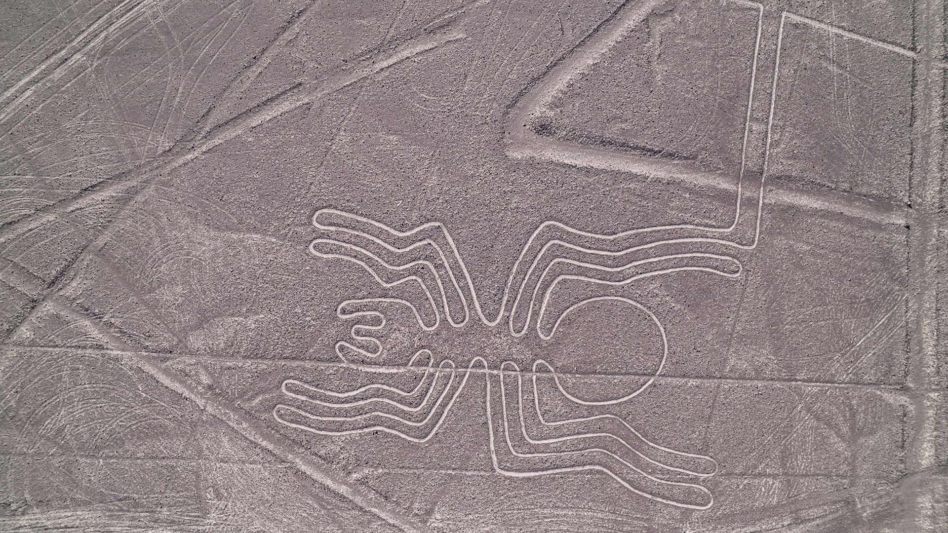
Researchers and archaeologists keep probing the enigma of the Nazca Lines, an extensive array of prehistoric ground figures in southern Peru that extend across more than 800 miles (1,300 kilometers) of desert terrain. Roughly two thousand years old, the motifs include stylized animals, plants and intricate geometric shapes, fueling continual discussion over their initial purpose.
A prominent hypothesis connects the drawings to water veneration, a reasonable incentive in an area where rain is limited and irrigation is vital for farming. Scholars note that many lines lie close to ancient aqueducts and ritual wells, implying the geoglyphs could have functioned as offerings or petitions to summon rain and support crops.
Another suggestion highlights a possible astronomical purpose for the lines. Some experts contend that specific figures line up with solstitial sunrise and sunset positions, indicating the Nazca might have employed the massive drawings as a terrestrial calendar to monitor seasonal shifts and direct planting schedules.
Beyond religious and celestial interpretations, newer research proposes that the lines acted as processional routes for ritual pilgrimages. Their enormous size—detectable only from above—suggests that participants could have traversed the paths while conducting ceremonies, bolstering communal identity and reinforcing social hierarchies.
Although no single theory has gained universal endorsement, scholars agree that the Nazca Lines probably served several functions, blending cosmology, environmental needs, and social customs. Building them demanded organized labor, exact planning, and deep familiarity with the desert’s stable crust, showcasing a sophisticated society adept at large‑scale engineering.
Protecting the geoglyphs has turned into an urgent concern as tourism expands and climate change endangers the delicate desert setting. UNESCO listed the site as a World Heritage property in 1994, and Peruvian officials now restrict aerial flights and vehicle traffic over the lines to curb erosion.
Upcoming research, employing high‑resolution satellite imagery and ground‑penetrating radar, seeks to chart yet‑unidentified figures and improve dating methods. As technology reveals additional details, scholars anticipate narrowing the spectrum of viable explanations and gaining clearer insight into the Nazca civilization’s motives.
At present, the Nazca Lines stand as a striking testament to ancient ingenuity, inviting both awe and academic investigation into how early societies expressed their bond with the natural world through monumental art.


Comments (0)
Be the first to comment.
Join the discussion