Gulf Low-Pressure Area May Strengthen into Hurricane as October Starts
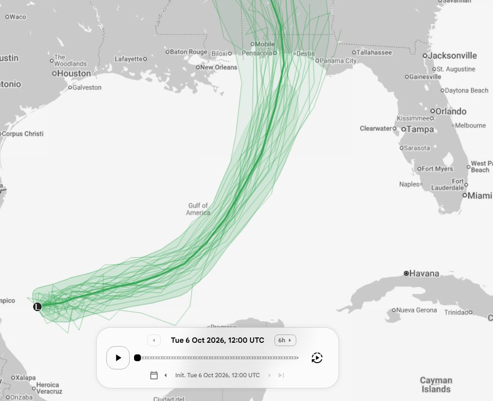
Forecasters at the National Hurricane Center are tracking a nascent low-pressure zone in the western Gulf of Mexico, projected to attain tropical storm intensity within 48 hours, while the newest ensemble of computer models assign it a solid probability of escalating to hurricane strength before landfall.
Positioned off Texas’ shoreline, the disturbance is already consolidating its convection and tightening its pressure gradient. Latest model outputs from the European Centre for Medium-Range Weather Forecasts and the U.S. Global Forecast System each indicate a gradual rise in wind speeds, with certain scenarios forecasting sustained winds above 74 mph as the system advances northeast toward the Gulf Coast.
Although the Atlantic hurricane season—spanning June 1 to November 30—regularly generates storms in early October, the specific timing and placement of this system have attracted notable focus. Historically, Gulf‑origin storms in this window can exploit warm sea‑surface temperatures and supportive upper‑level winds, fostering rapid intensification. The possibility of a hurricane materializing at this point in the season heightens urgency for communities still rebuilding from earlier storms.
Inhabitants along the coast—from southern Texas up to the western Florida panhandle—are being advised to reassess evacuation routes and emergency supply kits. Should the system stay at tropical storm strength, intense rain and storm‑surge flooding could still threaten low‑lying zones, particularly because the Gulf’s shallow waters tend to boost surge levels. Local officials have started pre‑positioning assets and revising public advisories ahead of the system’s arrival.
Meteorologists stress that the situation is still evolving. The National Hurricane Center will release its initial official advisory once the system satisfies tropical cyclone criteria, with later updates fine‑tuning the expected track and strength. Current model consensus leans toward a northeastward trajectory that might drive the storm inland over Louisiana or Mississippi, though minor shifts in steering currents could redirect the hazard eastward toward the Florida peninsula.
Over the next several days, forecasters will watch the system’s core structure, satellite pictures, and reconnaissance data to assess its evolution. Residents should remain updated via official sources, obey any watches or warnings, and resist complacency even if the storm ultimately stays below hurricane strength. The upcoming week will reveal whether the Gulf low‑pressure area turns into the season’s next significant threat or fades without serious consequences.



Comments (0)
Be the first to comment.
Join the discussion