Landsat 8 Reveals Stunning Underwater Topography of Great Bahama Bank
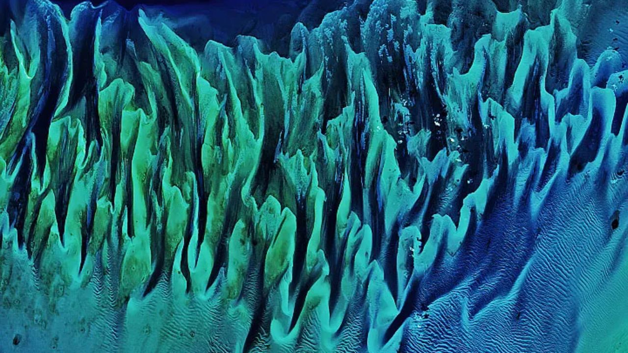
On February 15, 2020, the Landsat 8 satellite recorded a remarkable image, revealing a mesmerizing natural masterpiece across the Great Bahama Bank. This photograph vividly depicts 'painting-like' ripples, intricately shaped by submerged sandbanks and vast seagrass meadows within the Bahamas' shallow depths, providing a sublime glimpse into an ancient oceanic floor.
Such vivid formations, visible from orbit, underscore the powerful interaction of natural processes constantly shaping the area's submarine terrain. Ocean currents, tidal movements, and sediment transportation collectively forge an ever-changing panorama beneath the waves, exposing an intricate and stunning ecosystem.
The Great Bahama Bank stands as an immense underwater carbonate platform, ranking among the planet's largest, distinguished by its remarkably shallow depths. This sprawling geological structure is not merely an impressive natural wonder but also a vital element of the regional marine ecosystem, sustaining a variety of species, such as the essential seagrass beds featured in the photograph.
These types of images, initially publicized by LiveScience, extend beyond mere visual beauty. They furnish indispensable data for the scientific community. Through ongoing surveillance of these oceanic settings, specialists are able to observe shifts in sand and seagrass distribution, evaluate the condition of these critical habitats, and acquire greater understanding of sediment movement patterns across periods.
The Landsat program, a collaborative undertaking by NASA and the U.S. Geological Survey (USGS), has served as a foundational pillar in Earth observation for many decades. Landsat 8, deployed in 2013, upholds this tradition by delivering high-resolution images that are crucial for comprehending global environmental transformations, encompassing everything from landmasses to coastal and shallow-sea regions.
Such granular perspectives of these shallow aquatic environments hold particular significance for ecological oversight. They contribute to shaping conservation approaches, coastal planning initiatives, and endeavors to grasp how natural occurrences and human actions affect these fragile ecosystems. The capacity to discern such fine points from space underscores the profound capability of remote sensing.
Ultimately, the satellite's perspective not only exposes the deep splendor of our world's frequently concealed marine vistas but also emphasizes the essential requirement for continuous monitoring and scientific investigation. These visual documentations substantially enrich our shared understanding, aiding in the protection of these indispensable natural assets for generations to come.


Comments (0)
Be the first to comment.
Join the discussion